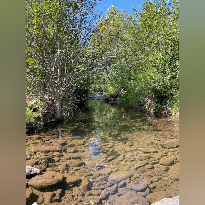
Projects

NF John Day Tributary Smallmouth Bass Monitoring

This project will assess the abundance, distribution and diet of SM bass in three tributaries of the NF John Day River (Cottonwood, Wall, and Rudio Creek). Activities will include a combination of snorkel surveys, mark-recapture monitoring with Passive Integrated Transponder (PIT) tags, stomach content sampling, sagittal otolith aging, stable isotope analysis, and bioenergetics modeling.

May contain: nature, outdoors, wilderness, land, creek, stream, water, plant, vegetation, jungle, rock, tree, woodland, pond, rainforest, grove, and swamp

Invasive species are a major threat to native salmonid recovery throughout the Columbia River Basin- with nonnative fishes being of particular concern.  Climate change compounds this threat by promoting the spread of non-native fish into habitats used by ESA listed steelhead and salmon for spawning and rearing. In the John Day River Basin, smallmouth (SM) bass are one of the most abundant non-native predators of salmonids throughout much of the system with a significant upstream range expansion predicted by 2080. There is a lack of information regarding their abundance, distribution, and impact on salmonids in the critical spawning and rearing tributaries of the North Fork John Day sub basin is of particular concern. If recovery efforts are to be successful at a basin-wide level, monitoring and assessment of nonnative fish in these critical spawning and rearing tributaries must be collected to inform restoration and management decisions that maximize juvenile salmonid survival.  Partners for the project include the Confederated Tribes of the Warms Springs Reservation of Oregon,  OWEB, and ODFW.


Engle Uplands Restoration

May contain: nature, outdoors, wilderness, plant, tree, fir, vegetation, and grass

The Engle Home Ranch is located in northwest Grant County approximately 13 miles south of the town of Monument, Oregon in the Cottonwood Creek drainage. Cottonwood Creek is a critical spawning and rearing habitat stream for ESA listed (Threatened) Middle-Columbia River steelhead that drains into the North Fork John Day River. Monument SWCD’s Cottonwood Creek Focus Area Action Plan has identified two spring fed project catchments (Long Hollow and an unnamed system) as likely to adversely affect water quality through the Water Quality Land Condition Assessment, with western juniper encroachment being a contributing factor to this classification. This project will see to machine cutting and piling of juniper in two units across 492 acres of these catchments. Recent studies have shown juniper removal to result in greater water quantity and quality while also benefitting wildlife habitat and rangeland health. Additionally, the increased prevalence and scale of wildfires across the west should place fuel reduction as a high priority objective for watershed management. Wildfire can have dramatic effects to stream discharge, turbidity, specific conductance, and dissolved oxygen. Partners for the project include the Confederated Tribes of the Warms Springs Reservation of Oregon, USDA – Natural Resources Conservation Service, Malheur National Forest, Oregon Department of Agriculture, Monument SWCD, private landowners, and OWEB.


North Fork John Day Leafy Spurge Project 2023

May contain: plant, vegetation, land, nature, outdoors, grass, wilderness, field, grassland, scenery, tree, woodland, and water

This project will treat the upper most 53.6 miles of leafy spurge infestation, focusing on the riparian and upland areas with the Fox/Cottonwood Basin (source population). Additionally, the project will treat Perennial Pepperweed, Houndstongue, Mediterranean Sage, and Whitetop as secondary targets when encountered.  Gross project area is 153,000 acres, maintaining the treated area established during the 2018 project. Net acres are expected to be approximately 220 acres. This project will build on past success using an integrated pest management approach that includes landowner outreach and education, herbicide treatments, targeted goat grazing, and biological control agents. Participating landowners will be asked to contribute a 25% match for work conducted within the Fox/Cottonwood drainage. NFJD River treatments will be conducted free of charge by raft. Landowners along the NFJD River with leafy spurge outside of the riparian zone will contribute the full cost of treatments or conduct treatments themselves due to past project success.


Cottonwood Creek Focus Area

Map of Cottonwood Creek Focus Area 2015-17

Cottonwood Creek is the largest tributary to the North Fork John Day River, and is prime spawning and rearing habitat for Mid-Columbia steelhead.  The Cottonwood Creek Basin is approximately 77,000 acres in size, with approximately 89% ( 68,462 acres) being private lands and 11% ( 8,542 acres) public lands.  Cottonwood Creek actually begins as Fox Creek in the uplands above the focus area and becomes Cottonwood Creek shortly after it enters the Monument SWCD boundaries.  The portion of the Cottonwood Creek Basin that will be included in the Focus Area will be the Middle Cottonwood Creek and the Lower Cottonwood Creek.  Cottonwood Creek proper is approximately 22 miles long, and there are approximately 130 miles of perennial and seasonal tributaries to Cottonwood Creek.  Predominant agricultural use of the basin is for livestock production, with the majority of acreage being used for grazing.  The upper reaches of Cottonwood Creek Basin additionally produce merchantable timber.  The lower 4 miles of the basin contain the majority of irrigated land, which is mainly used for hay production.

This basin was chosen to be the focus area primarily because of Cottonwood Creek's significance and importance for steelhead spawning and rearing habitat, but also because of the significant amount of private land in the basin where conservation practices are often allowed to be implemented.  Many projects have been implemented in the basin, including a significant amount of riparian fencing and planting, irrigation efficiency improvements, upland spring developments, juniper control, and diversion modifications to improve fish passage.  The Monument SWCD is currently working with several landowners to improve irrigation efficiencies, improve fish passage on irrigation diversions, and improve stream flows through juniper control.


Cottonwood Creek Steelhead and Stream Temperature Monitoring

Photo of Cottonwood Creek

High water temperatures and low summer time flows are primary limiting factors for ESA-listed Middle Columbia River summer steelhead populations in the John Day River Basin.  The MSWCD is working with landowners along Cottonwood Creek to implement conservation measures with a “win-win” approach that help provide more favorable conditions for ESA-listed steelhead and also benefit landowners’ management objectives.  This monitoring project will collect critical steelhead and water quality data to guide landowner coordination and the identification and implementation of future protection and restoration actions to ameliorate stream temperature and stream flow in Cottonwood Creek.  The data will be used to develop a stream temperature forecasting model and assess the success of future restorations actions within the watershed.  Partners for this project include Oregon Department of Fish and Wildlife (ODFW), the Confederated Tribes of the Warm Springs Reservation of Oregon (CTWS), The Freshwater Trust (TFT), and Sustainable Northwest (SNW).


Cottonwood Creek Fish Passage Improvements

Photo of a man standing near Cottonwood Creek

This is an OWEB funded Technical Assistance project that focuses on improving fish passage at an irrigation point of diversion on Cottonwood Creek where streambed erosion is degrading an existing diversion structure.  The MSWCD is working with project partners the Confederated Tribes of Warm Springs Reservation, USFWS Partners Program, Anderson Perry and Associates and landowners to develop design plans for a diversion control structure that will maintain fish passage and withstand a 100-year flood event.  Once design plans are finished, the MSWCD plans to apply for implementation implementation funding to begin in the summer in-stream work in the summer of 2021.  By improving and maintaining adequate passage conditions at this site, fish will have access to nearly 30 miles of critical spawning and rearing habitat in the middle and upper reaches of Cottonwood/Fox Creek.


Cavender Wetland Enhancment

Photo of  Cavender Wetland

This project is located on private property owned by the Jack E Cavender Trust in the southwest corner of Monument, Oregon within the Lower North Fork John Day watershed.  A 9.7 acre wetland occupies an abandoned sawmill pond that last operated in 1959.  The pond was originally formed by placing a levee across a large bend in the North Fork John Day River.  Severe streambank erosion put the levee at risk of failure that would have resulted in loss of the wetland.  A previous assessment of the wetland verified it has high values for habitat function and value, and is a locally rare habitat type.  This restoration project included the installation of a Large Wood Habitat Structure and Bio-engineered Streambank Protection to protect against further erosion, lowering of the remainder of the levee to the 2-year water surface elevation of the river to increase floodplain connectivity, creation of oxbow-like side channels within the wetland to increase habitat values, and control of invasive plants to promote the health and vigor of desirable species.  Match funds have been used to replant the site with native vegetation and to monitor habitat conditions for anadromous fish within the wetland.  A second phase of the project is planned that will continue to treat weeds and improve desirable vegetation within the wetland.  

To learn more about this project, check out the video link below put out by Oregon Lottery.

Cavender Wetland Project Video


Boag Creek Upland Restoration

Photo of Boag Creek Upland Restoration

Boag Creek is a perennial, non-fish bearing tributary of Cottonwood Creek located in northwest Grant County approximately 13 miles south of the town of Monument, Oregon.  Cottonwood Creek is a critical spawning and rearing habitat stream for ESA listed (Threatened) Middle-Columbia River steelhead that drains into the North Fork John Day River. This project will be implemented beginning in 2019 and see to hand cutting and piling of juniper across the entire 1,032-acre Boag Creek watershed.  Water temperature and flow monitoring will occur prior to treatment and continue for two years following the juniper removal to evaluate the effectiveness of the watershed scale juniper removal.  An additional 885-acres of juniper control will be conducted in adjacent drainages through matching funds provide by the Title II grant program and the Environmental Quality Incentives Program (EQIP).  Recent studies have shown juniper removal to result in greater water quantity and quality while also benefiting wildlife habitat and rangeland health.  Partners for the project include the USDA – Natural Resources Conservation Service, Malheur National Forest, Monument SWCD, private landowners, and OWEB. 


Top Ranch Integrated Resource Management

Photo of woods in Oregon

Top Ranch is located in northwest Grant County, Oregon approximately 7 miles north of the town of Monument.  It is situated within the Fern Creek and Indian Creek watersheds, both of which are tributaries of Big Wall Creek.  Big Wall Creek is a major tributary of the North Fork John Day River that provides critical spawning and rearing habitat for ESA listed (Threatened) Middle-Columbia River steelhead.  Western portions of Top Ranch were overstocked with timber species, which negatively affected forest health, reduced water availability, and increased the risk of catastrophic wildfire.  Western juniper is encroaching across other portions of the ranch negatively impacting the herbaceous understory and water quality/quantity.  Fern Creek runs through Top Ranch and currently lacks any exclusion from livestock.  The current manager of Top Ranch has implemented many integrated resource improvements over the last 5 years but wishes to accelerate the level of restoration across the ranch.  This project will implement 194 acres of juniper cutting, install 1.5 miles of riparian fencing on both sides of Fern Creek (15,584 feet), install a 6,242-foot cross fence, and develop 3 upland water sources (i.e., springs).  This will complement 437 acres of forest stand improvements that Top Ranch has conducting as match funding.  Partners for the project include Top Ranch, Monument SWCD, and OWEB.

.